Maps of Bordeaux in South West France
Maps from the region of Nouvelle Aquitaine in South West of France
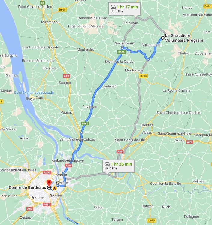
Bordeaux is located close to the European Atlantic coast, in the southwest of France and in the north of the Aquitaine region. It is around 500 km (310 mi) southwest of Paris and approx. 90 kilometres from La Giraudiere.
The city is built on a bend of the river Garonne, and is divided into two parts: the right bank to the east and left bank in the west. Here you will find a Map showing the distance between Bordeaux and La Giraudiere. There is also a google interactive map with Bordeaux center as it’s pick up point.
Bordeaux Map

Bordeaux is situated less then 90 km or 55 miles from La Giraudiere. There are several routes using either A roads or N roads. Use the interactive map above to see the different routes.
So as to check the weather before you depart check our weather station at Weather in Bordeaux we also have in place a page titled Bordeaux Airport ideal to find flights etc. Like to read more about Bordeaux then read our Article about Bordeaux
These maps and webpages have been produced and put in place by volunteers and interns who have taken part in the different programs at La Giraudiere. At the top of this page, you will find links to our different programs and how to contact us and links for more information about us. If you are looking for a new way to experience France then for sure we can oblige.